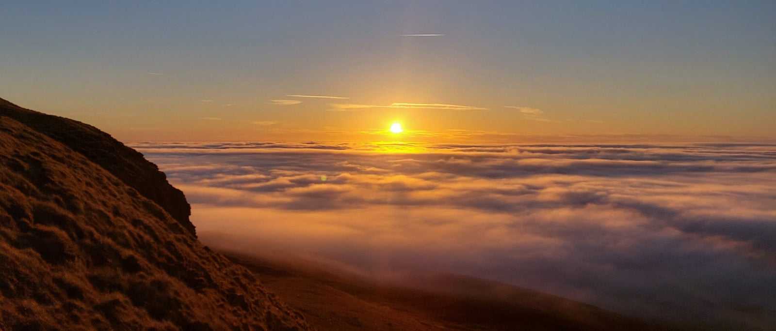

Of the many wonders found in the mountains, cloud inversions are one of the best. The sheer beauty of dark peaks rising like islands from an ocean of cloud is difficult to match. Cloud inversions are infrequent and elusive, which is part of their appeal. The specific meteorological conditions required can be challenging to predict, so there is always a bit of a gamble involved. With a bit of research, we can ascend into the clouds hoping to emerge above them into broad daylight, but we can never be certain until it happens.
Even on days where the conditions are favourable and an inversion seems likely, it is difficult to guess exactly which peaks will sit above the cloud, especially in Britain where our mountains are fairly small compared to other regions. This uncertainty can be frustrating and can lead to a day spent hiking in the cloud with little reward, but it is also part of the joy. One of the things that makes cloud inversions so enticing is the suspense of not knowing whether you will get above the cloud, and the sheer delight when you do.

This article aims to help improve your chances of catching a cloud inversion, though a degree of that uncertainty will always remain. There will be times when you succeed, and times when you don't. Only getting out into the hills and observing the weather patterns, particularly those in a specific area, can provide the experience needed to become an expert cloud inversion hunter. I'm certainly still learning, and I expect to be for the rest of my life. But if you're not sure where to start, then here are some useful tips.

The scientific name for a cloud inversion is 'temperature inversion'. Usually, air temperature will decrease as you ascend – although the rate of this decrease can vary. During a temperature inversion, this is reversed so that cooler air becomes trapped near the ground with a layer of warmer air above it. Clouds (or fog) can become trapped beneath an inversion, so they sit at a much lower height than usual – enabling people to hike or climb above the cloud and emerge into broad sunlight. This is what is known as a cloud inversion.


While cloud inversions can technically occur at any time of year, the seasons are not equal. Here is a rough breakdown of what to expect across the year in the UK.
Autumn is arguably the best season for cloud inversions in the UK, and the one most likely to reward a spontaneous decision to head for the hills. The combination of cooling nights, residual daytime warmth and increasing atmospheric moisture creates ideal inversion conditions – often with dramatic, layered cloud sitting in valleys below hillsides still bright with colour. Inversions in this period tend to form overnight and linger well into the morning before being burned off by the sun, giving you a wider window to get above the cloud.
Winter inversions are frequently the most dramatic. Long, cold nights allow air temperatures to drop sharply in valley bottoms, and the low winter sun may never be strong enough to break the inversion at all, meaning some last for days. However, the short daylight hours demand careful planning – a very early start or a wild camp at altitude is often the only way to be in position for the best light. Winter inversions are often made of dense fog rather than wispy cloud, producing that classic 'sea of cloud' effect.
Spring is transition season and inversions are less predictable, though by no means rare. In coastal mountain areas like Snowdonia, thick sea fog inversions are common as sea temperatures remain cold while the land begins to warm. As the season progresses, the strengthening sun burns inversions off more quickly, so early starts become increasingly important.
Summer inversions are the least common and the hardest to catch, since the shorter nights and strong sun make it difficult for cold air to settle and persist in valley bottoms. That said, they do happen – particularly at higher altitudes or on islands, where the surrounding sea provides consistent moisture. One of the best inversions I've ever witnessed was from the summit of Ben More on the Isle of Mull in August, which goes to show that the right conditions can always conspire in your favour.
Some locations are more suitable for the development of inversions than others, thanks to a combination of altitude, proximity to water and valley topography. Here are some of the most reliable spots in the UK.
With Ullswater to the east and Thirlmere to the west, Helvellyn benefits from the moisture provided by two significant lakes, making valley fog and cloud inversions relatively common. At 950m it sits well above typical inversion levels in the Lakes, and the long ridgeline gives excellent elevated views across a cloud-filled Cumbrian landscape.
Despite being only 694m, Pen-y-Ghent punches well above its height for inversions, owing to its position above broad, flat river floodplains that pool cold, moist air. It's the hill I return to most often for inversions, and the one I'd recommend to anyone starting out. The surrounding Three Peaks – Whernside and Ingleborough – provide additional viewpoints and are all within reach of each other on a good day.
At 1,085m and surrounded by lakes, rivers and the Welsh coastline, Snowdon is one of the most reliable places in the UK for catching a cloud inversion. Eryri National Park sits in a region with high atmospheric moisture year-round, and Snowdon's height means it clears the cloud layer with relative ease. Spring sea fog inversions here can be particularly thick and spectacular.
The highest peak in southern Britain at 886m, Pen-y-Fan is well-positioned above the broad valley floors of the Brecon Beacons, which are ideal for pooling cold, still air. The flat-topped summit provides unobstructed views across a sea of cloud when conditions are right, and the relatively accessible approach means it's a practical target for an early-morning inversion dash.
The Peak District's gritstone edges – Stanage, Curbar, Froggatt and others – sit at modest elevations but above sheltered valleys that frequently fill with mist and fog under high pressure. Because the edges are fairly low, you don't need a dramatic cloud inversion to find yourself above it; even a shallow layer of valley fog can produce a striking effect from the top of a gritstone edge at dawn.
At 1,345m, Ben Nevis is almost guaranteed to clear the cloud layer when inversions occur across the Scottish Highlands – though the long approach means it rewards planning rather than spontaneity. The Cairngorms plateau offers a different kind of experience, with wide open vistas above low-lying cloud filling Strathspey and the surrounding glens. Winter inversions across the Highlands can be among the most extraordinary in the UK.

The single biggest advantage you can give yourself when hunting cloud inversions is being at altitude before dawn. Most inversions – especially in autumn and winter – form overnight and are at their most dramatic in the hours around sunrise, before the sun has had a chance to burn off the cloud layer. Getting above the cloud at that hour requires either a very early start from the valley (often meaning a 3am alarm) or camping high the night before.
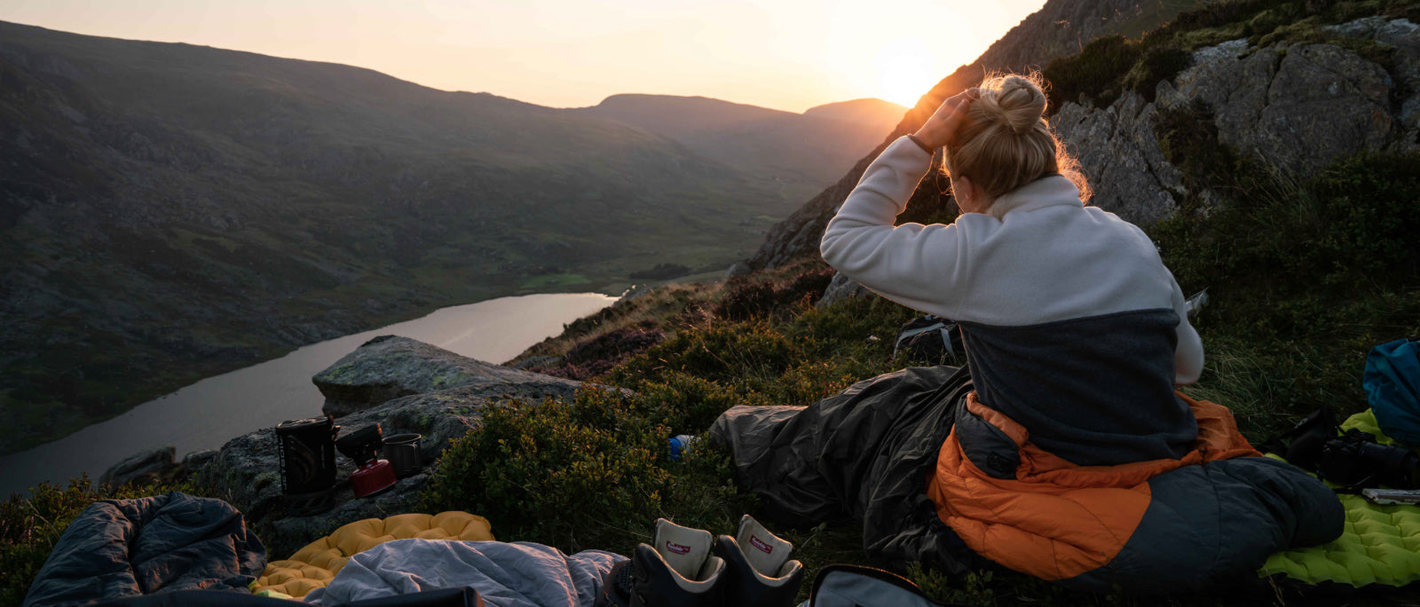
Wild camping at altitude puts you in the right place at the right time with none of the logistical pressure of a predawn race against the clock. You can settle in, watch the cloud fill the valleys below you as evening falls, and wake up already above it. Some of the most memorable inversions I've experienced have been the result of a slow, cold evening above the cloud followed by a sunrise that seems to set the whole landscape on fire.
To camp comfortably at altitude – particularly in the colder months when inversions are most likely – you'll need the right kit. A good sleeping bag rated for the expected temperatures is essential; on a clear, still night above the cloud, temperatures on exposed ridges and summits can drop sharply. A reliable tent that can handle wind and condensation is equally important, as is a well-insulated sleeping mat to protect against ground cold. Pack a stove for a hot drink before the pre-dawn start – it makes the early alarm considerably more bearable.
Wild camping is legal across most of Scotland under the Land Reform Act, but in England and Wales you will technically need to seek permission from the landowner, with the notable exception of some parts of Dartmoor. That said, a low-impact, leave-no-trace approach is widely tolerated in many upland areas. Always follow the principles of responsible wild camping: arrive late, leave early, and leave no trace.
No weather app explicitly predicts cloud inversions, but you can make a reasonable assessment of likelihood by working through the following conditions before heading out. The more boxes you can tick, the better your chances.
Some locations are more suitable for the development of inversions than others. For example, inversions are more common on hills with large bodies of water because they contribute to greater cooling of the air at ground level and higher moisture levels. Peaks near large lakes, such as Helvellyn, with Ullswater and Thirlmere either side, are good locations for this reason. Tall peaks on islands, such as Ben More on the Isle of Mull or Mount Teide on Tenerife, get cloud inversions very frequently due to being surrounded by the sea. Eryri (Snowdonia) National Park has the combined benefit of proximity to the sea, and valleys with large lakes and rivers, making cloud inversions relatively common there.
In the absence of lakes or the sea, low-lying floodplains and large rivers can also contribute to a cloud inversion by providing moisture and aiding the cooling of the air. I have seen many cloud inversions on Pendle Hill, despite its modest height of 557 metres, because it benefits from being surrounded by rivers and broad, flat floodplains (which often have stagnant bodies of water in winter).

Weather apps provide a range of information, and it can be difficult to know how to interpret this information to predict cloud inversions. To my knowledge, no existing weather app explicitly predicts cloud inversions. I have occasionally seen cloud inversions predicted on the Mountain Weather Information Service (MWIS), but most cloud inversions that I have seen have not been predicted on the site. As a result, we are left largely dependent on our own calculations and guesswork. It is also worth noting that the information on weather apps can be unreliable. On many occasions, I have been on the summit of a hill above an inversion, despite the weather apps indicating otherwise by forecasting the summit to be in fog, or for the summit temperature to be lower than the temperature in the valleys. I look at weather apps to look for general patterns that may make inversions likely, such as high pressure, high moisture and low wind speeds, but I don't always trust predictions of cloud base height. Ultimately, my primary judgment comes from walking outside and looking up at the mountains with my own eyes.
If you are looking at weather apps to inform your decisions, then you may want to consider:
I tend to use a combination of apps, because different apps provide different information and have different locations. Usually, I at least check: MWIS, Met Office mountain weather, Mountain Forecast and Yr (this is the forecast provided by the Norwegian Meteorological Institute, but with typical Scandinavian efficiency, it's also very good at predicting UK weather). The website windy.com also has a variety of webcams in mountain areas to aid decision making.
Before setting out in search of a cloud inversion, it can help to have an idea of some of the related phenomena that you may witness.

1. Brocken spectre - is when rainbow circles surround your shadow, in a halo-like shape. This occurs in the opposite direction of the sun, when the light casts your shadow onto a bank of cloud, so be sure to look in all directions when experiencing an inversion. Because the proximity of cloud is also important, brocken spectres usually occur when you're emerging out of the cloud, rather than when you're far above it.

2. Fog bow- looks like a rainbow of white light or extremely faded colour, and is much larger than a brocken spectre. It is caused by sunlight interacting with the water droplets in cloud or fog, similar to the way a rainbow is formed, but because the water droplets in fog are much smaller the colours are more muted. Fog bows need both sunlight and cloud to form, so they are often seen at the edge of the cloud layer during an inversion.
It should be apparent by now that inversions are dependent on a large number of variables and predicting them can be tricky. It does, however, get easier with time and experience. These days, although I briefly check the forecast in advance to see when an inversion is likely, most of the time I realise that there is an inversion when I leave my house in Yorkshire and see thick, freezing fog, or a low cloud base and unusually low temperatures. When alarm bells start ringing, I throw my pre-packed bag on my back and head up Pen-y-Ghent. Despite my best efforts in predicting inversions, I will never stop relishing the uncertainty of each experience, because it is that uncertainty that gets my adrenaline pumping and leads to overwhelming joy when I do break free of the cloud. Remember, inversions are a reward saved for those who dare to take a chance.

A cloud inversion – technically a temperature inversion – is a meteorological phenomenon in which the normal decrease in air temperature with altitude is reversed. Cool air becomes trapped near the ground beneath a layer of warmer air above, causing cloud and mist to pool at low level rather than dispersing upwards. The result is a 'sea of cloud' filling valley floors and lower hillsides, with mountain peaks emerging clearly above it into sunlight. When conditions are right, it is possible to hike or climb above the cloud layer and experience the inversion firsthand.
Autumn (September to November) and winter (December to February) are the most productive seasons for cloud inversions in the UK. Longer, colder nights allow valley air temperatures to drop significantly, creating the temperature differential needed for an inversion to form. Winter inversions in particular can be extraordinarily dramatic – dense fog filling the glens and valleys while summits bask in full winter sunshine. That said, inversions can and do occur in any season; spring sea fog inversions in Snowdonia are well-known, and high-altitude island peaks like Ben More on Mull can produce inversions even in midsummer.
Three main conditions tend to coincide in a good inversion: high atmospheric pressure (which creates a stable, calm atmosphere), high moisture levels in the valley air (which provide the raw material for mist and cloud to form), and little to no wind (which prevents the air layers from mixing). Additionally, clear skies overnight allow the ground to lose heat rapidly, cooling the air near the surface. When the dew point at valley level is close to the air temperature, fog is likely to form – and if that fog is trapped beneath a layer of warmer air above, you have an inversion.
No weather app explicitly predicts cloud inversions, but a combination of sources gives you the best picture. The Mountain Weather Information Service (MWIS) occasionally mentions inversion conditions in its forecasts and is worth checking for specific mountain areas. The Met Office mountain weather pages, Mountain Forecast and Yr (the Norwegian Meteorological Institute) are all useful for cross-referencing summit versus valley temperatures, wind speeds and humidity. Windy.com provides synoptic charts and mountain webcams that can help confirm conditions on the ground. Ultimately, stepping outside and observing the weather directly – thick valley fog, a low cloud base with a sharp upper edge, unusually cold ground temperatures – remains the most reliable indicator of all.
The best locations tend to combine sufficient altitude with proximity to a moisture source – lakes, rivers, the sea or broad floodplains. In England, Helvellyn in the Lake District (flanked by Ullswater and Thirlmere), Pen-y-Ghent and the Yorkshire Three Peaks, and the Peak District gritstone edges are all excellent. In Wales, Snowdon and the wider Eryri (Snowdonia) National Park benefit from coastal moisture and large valley lakes. Pen-y-Fan in the Brecon Beacons is one of the best spots in southern Britain. In Scotland, Ben Nevis and the Cairngorms offer the greatest altitude advantage, while island peaks such as Ben More on the Isle of Mull get inversions very frequently due to being surrounded by sea. Even modest hills like Pendle Hill in Lancashire can produce reliable inversions if they sit above flood-prone valley floors.
![]() |
![]() |